Woods Hole Institutions and Town of Falmouth Collaborate on Coastal Resiliency Plans

As the Marine Biological Laboratory actively shapes a plan to protect its campus from coastal flooding -- the risk of which is climbing, inevitably, with global temperatures and sea-level rise –it will benefit from a new grant that enables the Woods Hole community to coordinate its resiliency efforts with the Town of Falmouth.
The grant, awarded to MBL’s neighbor, Woods Hole Oceanographic Institution (WHOI), is one of 19 coastal resiliency projects the state of Massachusetts recently funded at a total of $4 million.
WHOI’s partners in the funded project are the MBL, the National Oceanic and Atmospheric Administration (NOAA) Northeast Fisheries Science Center in Woods Hole, and the Town of Falmouth.
“This grant funds the next phase of our planning, which is to take a wholistic view of coastal resiliency that ties the issues specific to our campuses with plans for the village of Woods Hole and the town of Falmouth,” says MBL Chief Operating Officer Paul Speer.
“We can’t exist as independent entities in this effort. We are all connected to town infrastructure – roadways, power, water, sewer lines – and we need to think about our neighbors as we try to start putting together long-term resiliency plans for our institutions,” Speer says.
The grant will allow the project partners to hire a contractor (The Woods Hole Group) to engage the local community, schools, businesses, and residents in a dialogue about coastal flooding risks; identify village flood pathways and vulnerabilities; and discuss long-term protective strategies.
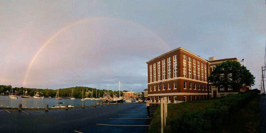 A rainbow arcs over Eel Pond after a storm. Credit: Danielle Upton
Thinking Ahead
A few years ago, WHOI, MBL and NOAA commissioned a comprehensive report on their projected vulnerabilities to sea-level rise, storm-surge inundation, and other climate-change related impacts over the next decades. That report, prepared by the Woods Hole Group, was delivered in October 2020.
Its projections -- which align with probabilistic models of sea-level rise used by the state of Massachusetts -- were sobering. Using 2008 data as a baseline, it projected that relative sea level in Woods Hole will rise by 1.27 feet by 2030, by 2.57 feet by 2050, and by nearly 8 feet by 2100. The rise in sea level brings increasingly higher risk both of “sunny day” tidal flooding, as well as storm-surge inundation during rainstorms, nor’easters, and hurricanes.
The report modeled the probability of flooding in Woods Hole with very high level of resolution (down to 5-10 foot parcels), which enabled the institutions to identify what buildings and other infrastructural elements are most at risk of “critical elevation flooding” that would prevent them from functioning.
For MBL, the buildings identified as highest flood risk are clustered around Eel Pond: Lillie Laboratory, the Marine Resources Center, Swope Conference Center, and Candle House.
The report also proposed concepts and designs for the institutions to mitigate their flooding risk.
“Right now, we are in phase 2, which is looking in detail at some of the solutions proposed during phase 1,” says Speer. “We are figuring out what actions we can take in the near term to protect our buildings from flooding, as well as considering long-term solutions and what they may cost.” Speer expects that a set of recommendations on how the MBL should move forward will be available by late 2023.
“At the end of the day, our ultimate plan will have some combination of renovations to Lillie Laboratory and Swope, and engineering controls that give us the ability to prevent the flow of water from getting into particular buildings on campus,” Speer says.
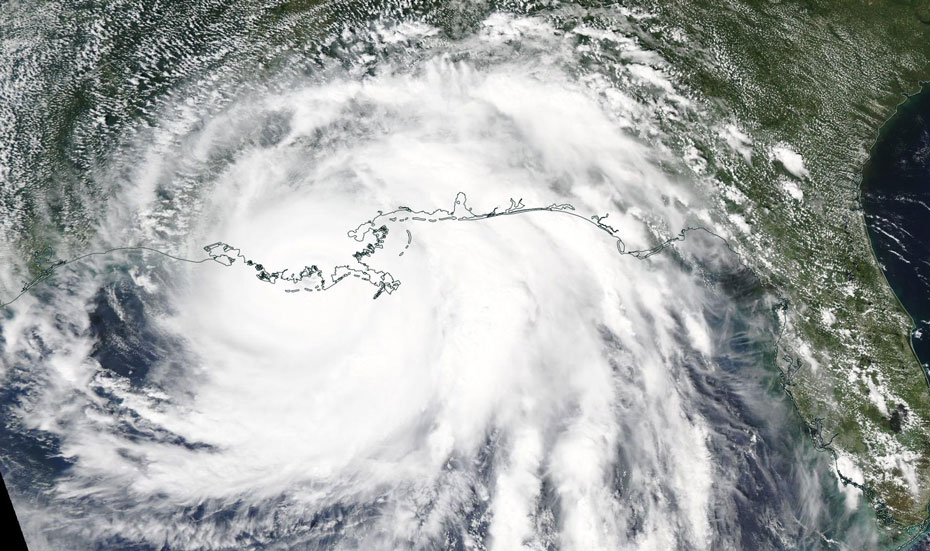 Hurricane Ida makes landfall in Louisiana on August 29, 2021 before moving up the East Coast, where it caused major flooding in the New York City region before arriving, diminished, in New England. Credit: NASA
Added Protection
Currently, MBL prepares vulnerable buildings for potential storm surge by blocking doorways and entrances with plastic-wrapped boards and sandbags, but this is labor intensive. One possible alternative is erecting modular walls along the Eel Pond seawall and at other potential flood points.
Conceptual planning is underway for a renovation of Lillie Laboratory, where critical mechanical, electrical, and other building systems are in the basement, below the flood level. These building systems are also nearing obsolescence, so they need to be both replaced and moved to higher elevation. “We would also like to renovate the Crane wing of Lillie for our imaging activities. So Lillie has a complex set of interacting issues going on, one of which is the resilience factor,” Speer says.
Some of Swope’s building systems are also in the lower level, and Speer and MBL Facilities Director Marie Russell have started looking at conceptual designs for moving them up.
While Loeb Laboratory is not one of the highest-risk buildings for critical elevation flooding, it has important resources in the basement, including the National Xenopus Resource which can’t be moved, and the MBL IT Department’s Data Center.
“Our goal for the basement of Loeb is to protect it from flooding,” Speer says. “The majority of the building is on higher ground and it would take a truly stupendous flood to reach it, but there’s an area along MBL Street, including a building entrance, where water potentially could get in and flood the lower floor. We need to find a better solution to protect it.”
As work continues to solidify MBL’s resiliency plan, Speer looks forward to beginning the phase 3 process of coordinating with other entities in Woods Hole, which the new state grant will fund.
The Massachusetts Coastal Resilience grants are awarded through the Office of Coastal Zone Management within the Executive Office of Energy and Environmental Affairs.